Tiedosto:Acer saccharum range map.svg

Tämän PNG-esikatselun koko koskien SVG-tiedostoa: 576 × 599 kuvapistettä. Muut resoluutiot: 231 × 240 kuvapistettä | 461 × 480 kuvapistettä | 738 × 768 kuvapistettä | 984 × 1 024 kuvapistettä | 1 968 × 2 048 kuvapistettä | 1 300 × 1 353 kuvapistettä.
Alkuperäinen tiedosto (SVG-tiedosto; oletustarkkuus 1 300 × 1 353 kuvapistettä; tiedostokoko 710 KiB)
| Tämä tiedosto on tiedostotietokanta Wikimedia Commonsista. Tiedot kuvaussivulta näkyvät alla. |  |
Tiedoston kuvaussivu Commonsissa |
Yhteenveto
| Kuvaus |
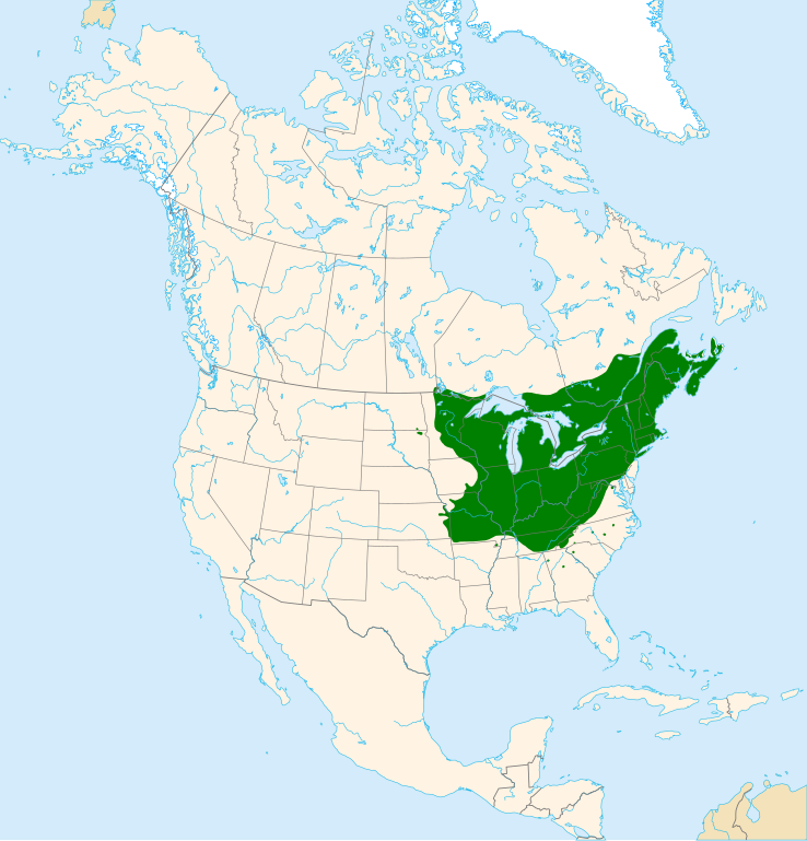
English: Range map of sugar maple (Acer saccharum).
Suomi: Sokerivaahteran (Acer saccharum) levinneisyys. |
| Päiväys | |
| Lähde | Oma teos |
| Tekijä | Halava |
Data sources:
- Coastlines, lakes, rivers, glaciers and political borders are from Natural Earth.
- Distributional data is from U.S. Geological Survey archive copy at the Wayback Machine.
Map projection: Lambert Azimuthal Equal Area Projection
Datum: North American Datum 1983
Lisenssi
Minä, tämän teoksen tekijänoikeuksien haltija, julkaisen täten tämän teoksen seuraavalla lisenssillä:
Tämä tiedosto on lisensoitu Creative Commons Nimeä-JaaSamoin 3.0 Ei sovitettu -lisenssillä.
- Voit:
- jakaa – kopioida, levittää ja esittää teosta
- remiksata – valmistaa muutettuja teoksia
- Seuraavilla ehdoilla:
- nimeäminen – Sinun on mainittava lähde asianmukaisesti, tarjottava linkki lisenssiin sekä merkittävä, mikäli olet tehnyt muutoksia. Voit tehdä yllä olevan millä tahansa kohtuullisella tavalla, mutta et siten, että annat ymmärtää lisenssinantajan suosittelevan sinua tai teoksen käyttöäsi.
- jaa samoin – Jos muutat tai perustat tähän työhön, voit jakaa tuloksena syntyvää työtä vain tällä tai tämän kaltaisella lisenssillä.
Tiedoston historia
Päiväystä napsauttamalla näet, millainen tiedosto oli kyseisellä hetkellä.
| Päiväys | Pienoiskuva | Koko | Käyttäjä | Kommentti | |
|---|---|---|---|---|---|
| nykyinen | 22. elokuuta 2012 kello 20.48 | | 1 300 × 1 353 (710 KiB) | Halava | New color scheme and projection |
| 22. elokuuta 2011 kello 16.06 |  | 2 000 × 2 000 (416 KiB) | Halava | {{Information |Description ={{en|1=Range map of sugar maple (''Acer saccharum'').}} |Source ={{own}} using Grass GIS and Inkscape. Data sources: * Coastlines, lakes, and borders are from [http://www.ngdc.noaa.gov/mgg/coast/ National Geophysica |
Tiedoston käyttö
Seuraava sivu käyttää tätä tiedostoa: