Tiedosto:Map of Alaska highlighting Yakutat City and Borough.svg

Tämän PNG-esikatselun koko koskien SVG-tiedostoa: 800 × 423 kuvapistettä. Muut resoluutiot: 320 × 169 kuvapistettä | 640 × 338 kuvapistettä | 1 024 × 541 kuvapistettä | 1 280 × 677 kuvapistettä | 2 560 × 1 353 kuvapistettä | 1 470 × 777 kuvapistettä.
Alkuperäinen tiedosto (SVG-tiedosto; oletustarkkuus 1 470 × 777 kuvapistettä; tiedostokoko 644 KiB)
| Tämä tiedosto on tiedostotietokanta Wikimedia Commonsista. Tiedot kuvaussivulta näkyvät alla. |  |
Tiedoston kuvaussivu Commonsissa |
Yhteenveto
| Kuvaus |
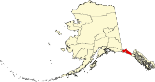
English: This is a locator map showing Yakutat City and Borough in Alaska |
| Päiväys | |
| Lähde |
Oma teos: English: The maps use data from nationalatlas.gov, specifically countyp020.tar.gz on the Raw Data Download page. The maps also use state outline data from statesp020.tar.gz. The Florida maps use hydrogm020.tar.gz to display Lake Okeechobee. |
| Tekijä | David Benbennick |
| SVG kehittely | Tämä vektorigrafiikkatiedosto luotiin käyttäen apuna ohjelmaa Adobe Illustrator, and with Inkscape. |
Lisenssi
| Minä, tämän teoksen tekijänoikeudellinen omistaja, julkaisen tämän teoksen public domainiin eli luovun kaikista tekijänoikeuksista lain sallimissa puitteissa. Tämä on voimassa maailmanlaajuisesti. Joissain maissa laki ei mahdollista tätä. Mikäli näin on: Myönnän kenelle tahansa oikeuden käyttää tätä teosta mihin tahansa tarkoitukseen, ilman mitään ehtoja, ellei laki vaadi ehtojen asettamista. |
Tiedoston historia
Päiväystä napsauttamalla näet, millainen tiedosto oli kyseisellä hetkellä.
| Päiväys | Pienoiskuva | Koko | Käyttäjä | Kommentti | |
|---|---|---|---|---|---|
| nykyinen | 25. kesäkuuta 2024 kello 22.11 | | 1 470 × 777 (644 KiB) | Nux | uniform colors with good contrast |
| 18. kesäkuuta 2024 kello 01.13 |  | 1 470 × 777 (338 KiB) | Nux | fix rendering (remove clipping) | |
| 24. elokuuta 2018 kello 22.32 |  | 1 470 × 777 (789 KiB) | NordNordWest | correct | |
| 13. helmikuuta 2009 kello 17.49 |  | 1 470 × 777 (370 KiB) | Niagara | correct | |
| 5. maaliskuuta 2006 kello 21.30 |  | 1 470 × 777 (338 KiB) | David Benbennick | {{subst:User:Dbenbenn/clm|county=Yakutat City and Borough|state=Alaska|type=borough and census area}} |
Tiedoston käyttö
Seuraavat 2 sivua käyttävät tätä tiedostoa:
Tiedoston järjestelmänlaajuinen käyttö
Seuraavat muut wikit käyttävät tätä tiedostoa:
- Käyttö sivustolla ar.wiki.x.io
- Käyttö sivustolla arz.wiki.x.io
- Käyttö sivustolla azb.wiki.x.io
- Käyttö sivustolla bpy.wiki.x.io
- Käyttö sivustolla ca.wiki.x.io
- Käyttö sivustolla ceb.wiki.x.io
- Käyttö sivustolla ce.wiki.x.io
- Käyttö sivustolla cy.wiki.x.io
- Käyttö sivustolla de.wiki.x.io
- Käyttö sivustolla en.wiki.x.io
- List of boroughs and census areas in Alaska
- Yakutat, Alaska
- Disenchantment Bay
- Yakutat Bay
- Russell Fiord
- Bering Glacier
- Vitus Lake
- Yahtse Glacier
- Guyot Glacier
- Wikipedia:WikiProject Alaska
- Mount Alverstone
- Mount Steller (Chugach Mountains)
- Fairweather Range
- Haenke Island
- Variegated Glacier
- New Russia (trading post)
- User:Nyttend/County templates/AK
- Template:Yakutat Borough, Alaska
- Mount Root
- Template:YakutatAK-geo-stub
- National Register of Historic Places listings in Yakutat, Alaska
- File talk:Map of Alaska highlighting Yakutat City and Borough.svg
- Situk River
- Cape Yakataga, Alaska
- Yahtse River
- Agassiz Glacier (Alaska)
- Yakutat Glacier
- Brabazon Range
- Mount Aylesworth
- Mount Armour
- Mount Duff (Yakutat)
- Mount Jetté
- Mount Herbert (Yakutat)
- Mount Lodge (Yakutat)
- Mount Hay (Yakutat)
- Mount Barnard (Alsek Ranges)
- Mount Harris
- User:AridCeption/sandbox
- Käyttö sivustolla eo.wiki.x.io
- Käyttö sivustolla es.wiki.x.io
Näytä lisää tämän tiedoston järjestelmänlaajuista käyttöä.