Tiedosto:Nysa location map.png

Tämän esikatselun koko: 587 × 599 kuvapistettä. Muut resoluutiot: 235 × 240 kuvapistettä | 470 × 480 kuvapistettä | 753 × 768 kuvapistettä | 1 166 × 1 190 kuvapistettä.
Alkuperäinen tiedosto (1 166 × 1 190 kuvapistettä, 1,6 MiB, MIME-tyyppi: image/png)
| Tämä tiedosto on tiedostotietokanta Wikimedia Commonsista. Tiedot kuvaussivulta näkyvät alla. |  |
Tiedoston kuvaussivu Commonsissa |
| Kuvailu |
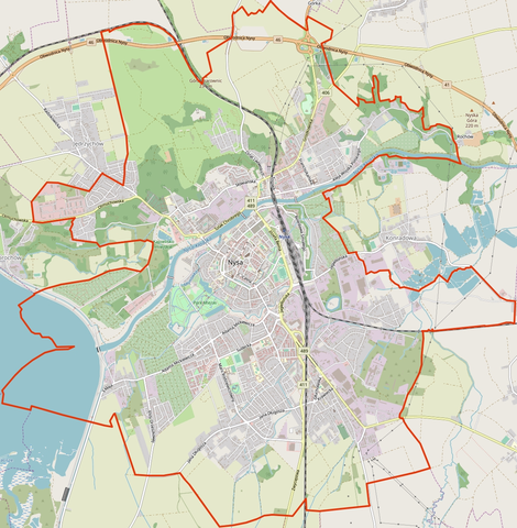
Location map of Nysa, Poland This map of Nysa was created from OpenStreetMap project data, collected by the community. This map may be incomplete, and may contain errors. Don't rely solely on it for navigation. |
|||||||||
| Päiväys | (see file history) | |||||||||
| Lähde | You may find a page on the OpenStreetMap wiki page for Nysa | |||||||||
| Tekijä |
OpenStreetMap contributors OpenStreetMap contributors |
|||||||||
| Käyttöoikeus (Tämän tiedoston uudelleenkäyttö) |
OpenStreetMap data is available under the Open Database License (details). Standard style map tiles are licensed as ODbL Produced Works.
|
|||||||||
| Ajan ja paikan tiedot | ||||||||||
| Rajausalue |
|
|||||||||
| Georeferointi | If inappropriate please set warp_status = skip to hide. | |||||||||
Tiedoston historia
Päiväystä napsauttamalla näet, millainen tiedosto oli kyseisellä hetkellä.
| Päiväys | Pienoiskuva | Koko | Käyttäjä | Kommentti | |
|---|---|---|---|---|---|
| nykyinen | 17. huhtikuuta 2019 kello 18.58 | | 1 166 × 1 190 (1,6 MiB) | ElCet | Updated the look of the map. |
| 5. joulukuuta 2013 kello 14.10 |  | 863 × 878 (545 KiB) | Powerek38 | VicuñaUploader 1.20 |
Tiedoston käyttö
Seuraava sivu käyttää tätä tiedostoa:
Tiedoston järjestelmänlaajuinen käyttö
Seuraavat muut wikit käyttävät tätä tiedostoa:
- Käyttö sivustolla id.wiki.x.io
- Käyttö sivustolla pl.wiki.x.io
- Państwowa Akademia Nauk Stosowanych w Nysie
- Zakład Samochodów Dostawczych
- Synagoga w Nysie
- Dekanat Nysa
- Bazylika św. Jakuba i św. Agnieszki w Nysie
- Carolinum (Nysa)
- Stara Synagoga w Nysie
- Kościół Świętych Apostołów Piotra i Pawła w Nysie
- Dom Wagi Miejskiej w Nysie
- Cmentarz żydowski w Nysie
- Nysa (stacja kolejowa)
- Nysa Dworzec Mały
- Nysa Nowy Świat
- Parafia Matki Boskiej Bolesnej w Nysie
- Parafia św. Dominika w Nysie
- Parafia św. Jana Chrzciciela i św. Mikołaja w Nysie
- Parafia św. Franciszka z Asyżu w Nysie
- Parafia św. Apostołów Piotra i Pawła w Nysie
- Parafia św. Elżbiety Węgierskiej w Nysie
- Parafia św. Jakuba Starszego i św. Agnieszki Panny Męczennicy w Nysie
- Kościół św. Franciszka z Asyżu w Nysie
- Rynek w Nysie
- Kościół Wniebowzięcia Najświętszej Marii Panny w Nysie
- Kościół św. Dominika w Nysie
- Karłów (Nysa)
- Śródmieście (Nysa)
- Kościół Matki Bożej Wspomożenia Wiernych w Nysie
- Kościół św. Rocha i św. Sebastiana w Nysie
- Kościół św. Elżbiety Węgierskiej w Nysie
- Kościół Świętego Krzyża w Nysie
- Kościół Matki Boskiej Bolesnej w Nysie
- Kościół św. Jana Chrzciciela i św. Mikołaja w Nysie
- Kościół Zwiastowania Najświętszej Maryi Panny w Nysie
- Kościół ewangelicki w Nysie
- Wieża Ziębicka w Nysie
- Wieża Wrocławska w Nysie
- Dwór Biskupi w Nysie
- Park miejski w Nysie
- Rynek Solny w Nysie
- Ulica Sukiennicza w Nysie
- Zbór Kościoła Adwentystów Dnia Siódmego w Nysie
- Nysa Miasto
- Nysa Górna Wieś
- Lądowisko Nysa
- Muzeum Powiatowe w Nysie
- Moduł:Mapa/dane/Nysa
- Dolna Wieś (Nysa)
- Górna Wieś (Nysa)
- Jędrzychów (Nysa)
Näytä lisää tämän tiedoston järjestelmänlaajuista käyttöä.